When shipping to Central Asia, many customers' first reaction is "use Khorgos or Alashankou." But if your cargo's destination is Kyrgyzstan, Tajikistan, Pakistan, or deep into Uzbekistan's Fergana Valley, going via northern Xinjiang ports often means detouring over a thousand kilometers, several extra days, and higher freight.
Southern Xinjiang's four highway ports — Irkeshtam, Torugart, Karasu, Khunjerab — connect to four southern directions of Central Asia. Choosing the right port is the first step to cutting transit time and controlling cost. This article explains each port's geography, destination country, suitable cargo, and clearance traits in full, so you pick the right route before placing an order.
1. Southern Xinjiang's Four Ports at a Glance: One Map Shows Who Leads Where
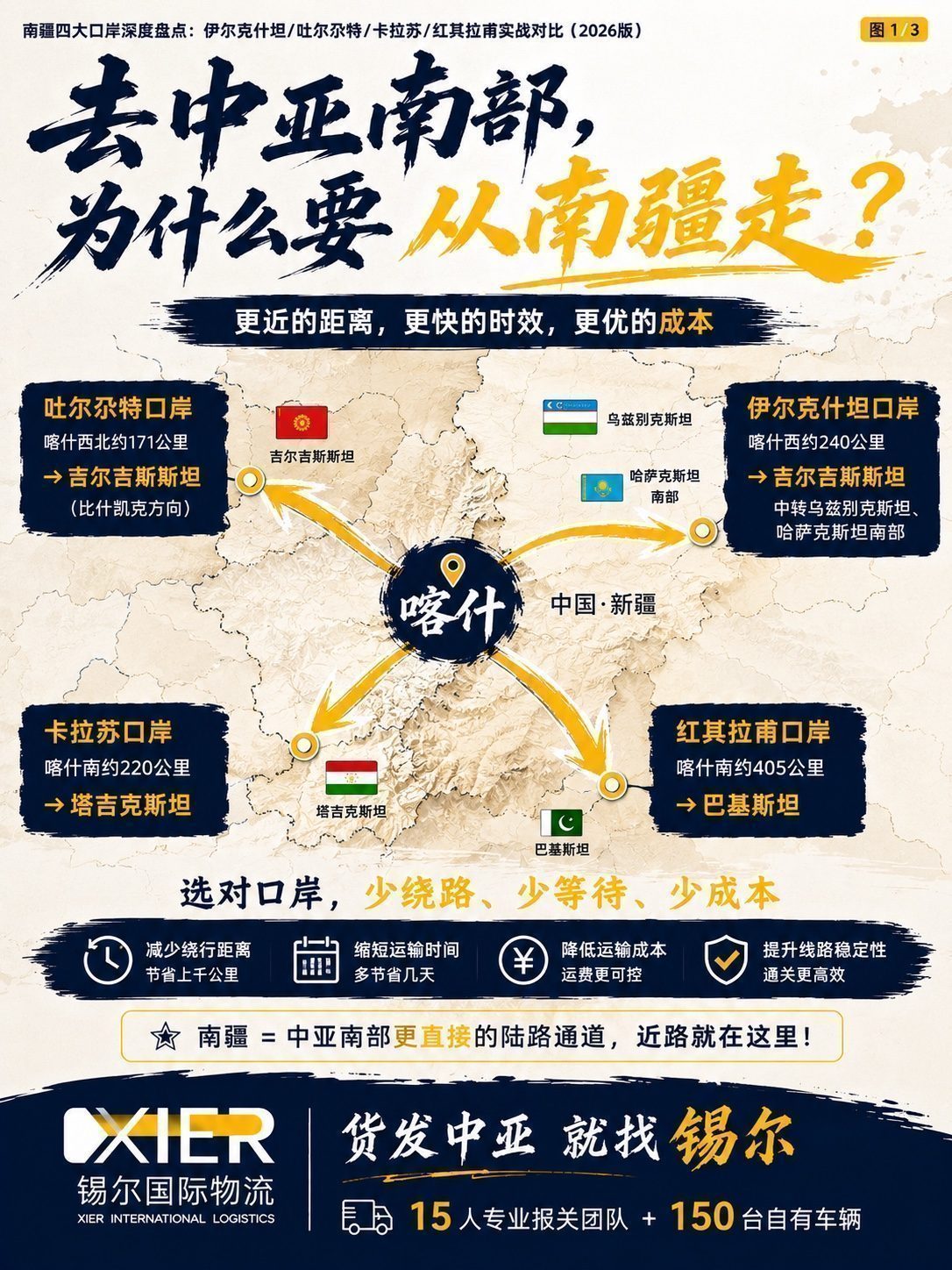
All four ports radiate from Kashgar as the distribution hub, but their directions and destination countries differ completely. Remember the basic mapping:
- Irkeshtam port → Kyrgyzstan (Osh)
- Torugart port → Kyrgyzstan (Bishkek)
- Karasu port → Tajikistan
- Khunjerab port → Pakistan
All four are highway ports, mainly full truckload (FTL) and less-than-truckload (LTL) road transport. Xier International Logistics keeps on-site field teams and its own cross-border vehicles at major southern Xinjiang ports.

2. Irkeshtam Port: The Main Corridor from Southern Xinjiang to Central Asia's Interior
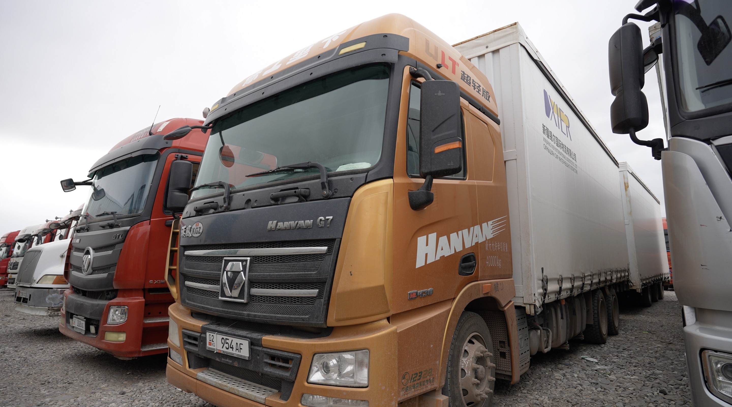
Irkeshtam (the Simuhana direction west of Torugart) is the highest-volume and most frequently used port in southern Xinjiang.
Key distance data (Xier measured): after exiting Irkeshtam, about 916 km to Tashkent, 1,294 km to Samarkand, 1,586 km to Bukhara.
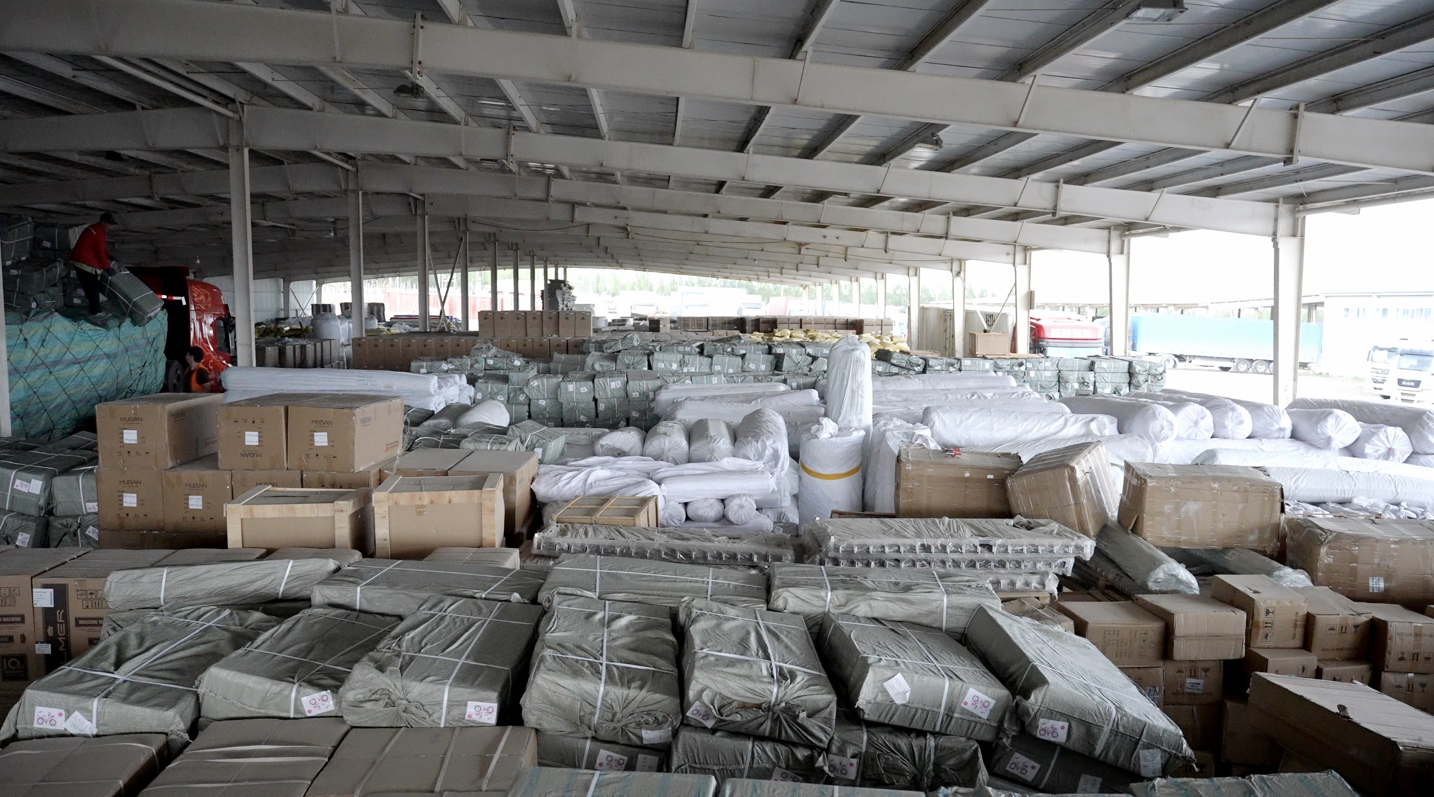
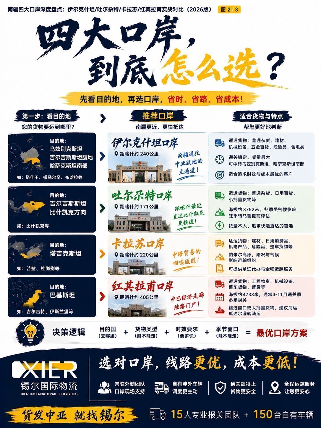
Suitable cargo: general goods, building materials, machinery and equipment, hardware and consumer goods, plus southern-Xinjiang-scarce dangerous goods and lithium-containing cargo.
3. Torugart Port: The Closest Kyrgyzstan Gateway to Kashgar
Torugart is only about 171 km from Kashgar — the closest of the four southern Xinjiang ports to the distribution hub.
Note: Torugart sits at high altitude (about 3,752 m); winter climate causes periodic clearance-rhythm changes, and peak-season truck queuing needs advance assessment. Xier's resident team tracks port clearance status in real time to avoid "stuck on the road" surprises.
4. Karasu Port: The Throat of China–Tajikistan Trade
Karasu is about 220 km from Kashgar — Xinjiang's port to Tajikistan.
Karasu is also on the Pamir Plateau; road conditions and climate are key variables in transport planning. FTL and dangerous-goods transport have steady demand on this lane; Xier provides document agency meeting Tajik requirements and full tracking. For an in-depth analysis of the Tajikistan market, see "Tajikistan Transport Market Deep Dive."
5. Khunjerab Port: The Land Gateway of the China–Pakistan Economic Corridor
Khunjerab is about 405 km from Kashgar — China's only land port with Pakistan.
At about 4,733 m, Khunjerab is one of the world's highest land ports, clearly affected by seasons.
6. How to Choose Among the Four Ports? A Decision Map
The core logic is simple: first look at the destination country, then at cargo type and time window.
- Destination Uzbekistan / Kyrgyzstan interior / southern Kazakhstan → Irkeshtam
- Destination Bishkek, Kyrgyzstan, small volume, need speed → Torugart
- Destination Tajikistan → Karasu
- Destination Pakistan, within the April–November clearance season → Khunjerab
Emphasis: port choice is not an isolated decision — it must also consider whether cargo is dangerous, whether transshipment is needed, and destination clearance requirements. This is exactly where a professional forwarder adds value: connecting "port selection" with "route planning, document prep, and clearance monitoring" as one flow, instead of letting shippers trial-and-error.
Frequently Asked Questions

Q1: Can all four southern Xinjiang ports handle dangerous goods?
Dangerous-goods transport demands high certification, vehicles, and documents; few southern Xinjiang forwarders can handle it. Xier International Logistics has dangerous-goods capability and can organize compliant dangerous-goods FTL at major ports like Irkeshtam. Whether a specific cargo can move and via which port must be confirmed case by case by dangerous-goods category and destination-country rules — consult in advance.
Q2: How far is each port from Kashgar?
Measured highway distances from Kashgar: Torugart ~171 km, Karasu ~220 km, Irkeshtam ~240 km, Khunjerab ~405 km. Kashgar is the distribution hub; cargo usually consolidates there first, then is dispatched to the corresponding port for exit.
Q3: Does Khunjerab really close in winter?
Yes. At ~4,733 m, affected by plateau climate, Khunjerab's main clearance season is roughly April–November; it closes in winter. Land cargo to Pakistan must factor the seasonal window into planning; if the window is missed or volume is large, consider the sea-to-Gwadar-then-road alternative.
Q4: I'm not sure which port to use — can you plan it for me?
Yes. Just provide cargo type, weight and volume, destination country and city, and desired transit time. Xier's team combines port clearance status, road/season conditions, and whether it's dangerous goods to recommend a port and an overall transport plan, including customs clearance, vehicle arrangement, and full tracking.
Q5: Does Xier have its own fleet and staff at southern Xinjiang ports?
Yes. Xier International Logistics keeps resident field teams at major southern Xinjiang ports and operates its own cross-border vehicles. Having people on-site and its own trucks means loading notices, customs-inspection follow-up, and delay alerts land immediately — a core capability many southern Xinjiang forwarders lack.
About the Author: Xier International Logistics specializes in Central Asia logistics market analysis and digital solutions. This article is based on Xier International Logistics' 10 years of frontline data and industry research and is for reference only; specific plans should be tailored to cargo characteristics.